
| Overview | Data | Maps | Software | Publications | News |
Please contact us if you find errors or have problems with the data or with this web site.
As originally part of a National Science Foundation funded project to investigate the effects of deep convection on the stratosphere, the authors merged radar reflectivity data from 125 National Weather Service NEXRAD WSR-88D weather radars to produce hourly, three-dimensional, high-resolution analyses of radar reflectivity that cover most of the contiguous U.S. The gridded radar data, known as GridRad V3.1, covers the period 1995 through 2017.
In 2022, leveraging support from the National Aeronautics and Space Administration and the National Oceanic and Atmospheric Administration, two new archives of GridRad data (built using V4.2 of our algorithm) were released to the public: an hourly archive of GridRad volumes covering the entire contiguous U.S. and including radar reflectivity and velocity spectrum width from 2008-2021, and a 5-min archive of GridRad volumes for ~100 of the most severe weather events each year from 2010-2021. The GridRad-Severe volumes include up to 7 variables: radar reflectivity, velocity spectrum width, azimuthal shear of the radial velocity, radial divergence of the radial velocity, and (for years 2013 and later) differential radar reflectivity, specific differential phase, and copolar correlation coefficient. GridRad-Severe data are expected to be routinely updated each year into the future.
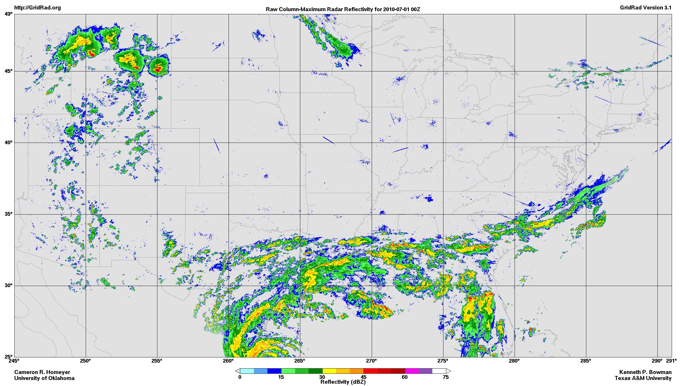
A sample GridRad radar reflectivity map is shown below at reduced size.
The original NEXRAD Level 2 data (volume scans) from individual radar sites were obtained from the NOAA National Centers for Environmental Information (formerly NCDC) and from Amazon Web Services and Google cloud storage systems. The Level 2 data for this time period are approximately 270 TB (compressed).
The NEXRAD Level 2 data from multiple radar sites have been merged and gridded to a regular, high-resolution (~0.02° x ~0.02° x 0.5-1 km), three-dimensional, longitude-latitude-altitude, Cartesian grid using software developed by Cameron Homeyer. Analyses are available at hourly synoptic times for the contiguous U.S. V3.1 and V4.2 archives (00Z, 01Z, ..., 23Z) and at regular 5-min intervals for the V4.2 GridRad-Severe archive (0000Z, 0005Z, 0010Z, ...). The GridRad V3.1 files for 1995-2017 require ~4.6 TB of storage. The GridRad V4.2 files for the hourly archive and GridRad-Severe archive currently require ~3.8 TB and ~32.1 TB, respectively. Click here for information on how to obtain GridRad data from the NCAR Research Data Archive.
Information about the methods used to create the gridded reflectivity fields, along with details of the data file contents, can be found in one of the following algorithm description documents for each version:
| GridRad Version 3.1 Algorithm Description document |
| GridRad Version 4.2 Algorithm Description document |
The radar data used to create the GridRad analyses were collected by the U.S. NEXRAD WSR-88D radar network, which is operated by the National Weather Service, an agency of the National Oceanic and Atmospheric Administration within the Department of Commerce. The NEXRAD data were obtained from the NOAA National Centers for Environmental Information (formerly NCDC) and from Amazon Web Services.
Creation of V3.1 of this data set was funded by National Science Foundation grants AGS-1522906 to Texas A&M University and AGS-1522910 to the University of Oklahoma: Collaborative Research: Observational and Modeling Studies of Overshooting Convection and Stratosphere-Troposphere Exchange. Additional support was provided to Kenneth Bowman by the David Bullock Harris Professorship in the College of Geosciences at Texas A&M University. Creation of V4.2 of this data set was funded by National Aeronautics and Space Administration grant 80NSSC19K0341 to Texas A&M University and by National Oceanic and Atmospheric Administration Joint Technology Transfer Initiative grant to the University of Oklahoma.
We thank the Texas A&M University High Performance Research Computing center for providing computer facilities to process part of the GridRad data.
We also thank the NCAR Research Data Archive for hosting the GridRad data.
The authors thank David Solomon, John Cooney, Tyler Fenske, Synclaire Truesdale, Amanda Murphy, and Kiley Allen for their contributions to many stages of the creation of the GridRad data.